
Opinion
The Map That Every Africa Trade Strategist Should Have on Their Wall
Forget GDP charts. The real story of African commerce is written in steel, asphalt, and pipeline – and three seismic shifts in the past two years are rewriting it entirely.

By John Kourkoutas
Most executives who claim to understand African trade have never truly studied a corridor map. They scrutinize GDP rankings, demographic projections, and AfCFTA implementation schedules.
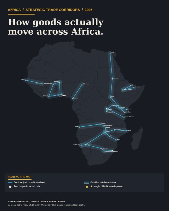
What they overlook are the physical arteries – the roads, railways, and pipelines that connect Atlantic, Indian Ocean, and Mediterranean ports to the landlocked interior of the continent. Those corridors are not merely a logistical detail. They are the binding constraint on everything else.
Three major developments along these corridors, each unfolding within the past 24 months, have materially altered the calculus for exporters and sourcing managers alike. Almost none of them have registered outside the narrow trade-finance bubble.
The Lobito Corridor Has Moved from Concept to Commerce
For years, the Lobito Corridor existed primarily as a slide in development-finance presentations. That changed in August 2024, when the first copper shipment from the Democratic Republic of Congo crossed Angola via the Lobito Atlantic Railway and arrived in the United States.
By the end of 2025, the project had secured a US$753 million financing package – US$553 million from the U.S. Development Finance Corporation and US$200 million from South Africa’s Development Bank of Southern Africa. Construction bids for the extension into Zambia are expected in May 2026, with a target completion date of 2030.
This is the Western answer to China’s Indian Ocean corridor strategy. By routing Congo’s copper and cobalt out through the Atlantic rather than eastward to Dar es Salaam or Mombasa, the corridor fundamentally reorganizes the geography of critical mineral supply chains.
For companies sourcing lithium, cobalt, or copper for battery and defense manufacturing, this single infrastructure project will reshape procurement realities by 2028. Those who wait to notice will be reacting rather than positioning.
Berbera Is No Longer Djibouti’s Understudy
The port of Berbera, in Somaliland, now handles roughly 22 percent of Ethiopia’s maritime trade – a figure that would have seemed implausible a decade ago. DP World has committed up to US$1 billion over ten years to develop the facility, and the Hargeisa bypass road has cut transit times by 38 percent.
Late 2025 floods damaged a key bridge along the corridor, but reconstruction is underway under the NBHH project.
Berbera is no longer a contingency option. It is a functioning second port, and its strategic importance to Ethiopia – a landlocked nation of 130 million people – will only grow.
Any shipper routing cargo into Ethiopia who remains entirely dependent on Djibouti is carrying concentration risk that deserves serious scrutiny.
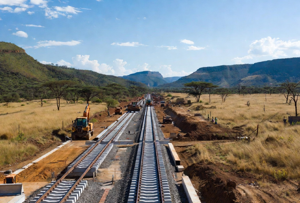
The Standard Gauge Railway Is About to Redraw East Africa’s Trade Map
In March 2026, construction broke ground on the long-anticipated Standard Gauge Railway (SGR) extension from Naivasha to Kampala. The implications are profound. Upon completion, freight transit from Mombasa to Kampala – currently a seven-day ordeal – will fall to under 24 hours.
Costs are projected to roughly halve. Uganda has signed a US$2.2 billion agreement with Turkish contractor Yapı Merkezi for the Malaba-to-Kampala section alone.
The Northern Corridor already moves 85 percent of East African Community trade. With the SGR upgrade, it will become the dominant freight artery for Uganda, Rwanda, and eastern DR Congo simultaneously.
Companies building sourcing or distribution strategies in the region without modeling this shift are working from an outdated map.
What This Means in Practice
The port through which goods enter Africa is not an operational logistics decision. It is a strategic one with direct margin implications.
For Zambia-bound cargo, choosing Walvis Bay over Mombasa can eliminate weeks from transit time. For shipments destined for Lubumbashi, routing through Lobito rather than Dar es Salaam can alter landed costs significantly enough to swing project economics.
Too many mid-sized European exporters still default to the geographically closest port on the map – a heuristic that works tolerably well from Hamburg to Antwerp, and catastrophically poorly across sub-Saharan Africa. African trade is not a scaling problem. It is a corridor problem.
The right sequencing is this: read the corridors first, select the market second. The product strategy, by comparison, is the straightforward part.
John Kourkoutas is business development expert that specializes in helping companies, export teams, and business leaders succeed in Africa’s dynamic and emerging markets.
